Friday, 30 March 2012

The wonder in the woods - Ulakkai Aruvi

Ulakkai Aruvi Waterfall


Ulakkai Aruvi is a natural waterfall situated in Azhagiapandipuram village of Thovalai Taluk.  It is located at a distance of 40 Km from Kanyakumari and about 17 km from Nagercoil town.It takes more than an hour's drive plus some walking to get there but due to its popularity many people go there.It is a beautiful fall on Pazhayar.It is named so as it resembles a wooden equipment in the shape of hour glass. Water is available in this water fall in the summer season.  Many tourists come here for bathing and to enjoy the nature.  The pathway to this waterfall lies in the Reserve Forest.


The way to ulakkai aruvi is much difficult. To reach the Higher falls, one needs to climb about 200 meters uphill.. Do it guyzz...its fun... one thing, wear hard shoes or boots 'coz there are worms.. keep raincoats , cameras and other equipments you need.


Special Attractions : The Greenery around the water falls will be soothing to eyes.


Landmark :    40 Km from Kanyakumari

How to reach??

Nearest Airport: Trivandrum International Airport (kerala)
Nearest Railway station: Nagercoil (Tamilnadu)

Images for Ulakkai Aruvi..


Athirapally falls - A magic of nature

Athirapally falls


Athirapally waterfalls is a magical face of nature located in Kerala, India. Its beauty attracts tourists from all over the world. Moreover, it is called the Niagra of India. from this itself we can understand the beauty of it. It is situated in Athirappilly panchayath in Thrissur district of Kerala, on the southwest coast of India. Located on the west-flowing Chalakudy River near the Vazhachal Forest Division and the Sholayar ranges, this 24-metre (80 ft) waterfall and the nearby Vazhachal Falls are popular tourist destinations.


 The 145 kilometres (90 mi) long Chalakudy River, originates in the Anamudi mountains of the Western Ghats[1] and flows through the Vazhachal Forest toward the Arabian Sea. The river initially runs smoothly but becomes more turbulent as it nears Athirappilly. At Athirappilly Falls, the water surges around big rocks and cascades down in three separate plumes. Below the falls, the river remains turbulent for about 1 kilometre (0.62 mi) until it reaches Kannamkuzhi. Then it calms and flows smoothly until reaching the dam at Thumburmuzhi.


The railway station nearest Athirappilly Falls is 30 kilometres to the west in Chalakudy, and the nearest airport is Kochi International Airport, about 55 kilometres southwest of the waterfall and 58 kilometres south of Thrissur. Athirappilly is easily reachable from Chalakudy by taxi or by bus from the Chalakudy private bus terminal. Athirappilly is situated on the highways connecting Tamil Nadu and Kerala, amidst thick forest, so night riding is not advised. The journey from Chalakudy to the Athirappilly Falls passes through a landscape of winding roads, small villages and lush green trees. Visitors can reach the top of the waterfall via a paved path that leads through thick bamboo clusters. A steep narrow path also leads to the bottom of the falls. The falls attract visitors from across India, especially during the monsoon months (June–September). About 7 million tourists visit the falls and the Vazhachal picnic spot each year.


shooting of Raavan in athirapally falls
The scenic beauty of Athirappilly falls has always been attractive to filmmakers. This falls is used as a location for several Malayalam Films. Major portion of 1986 Tamil movie Punnagai Mannan was shot near the falls, the Falls itself playing a role in it. It made the Falls a popular one in Tamil Nadu that it got the nickname "Punnagai Mannan Falls". The 2007 bollywood movie Guru used Athirappilly Falls as one of its locations. Rajiv Menon, the cinematographer of the movie, chose Athirappilly Falls as a background for one of its songs. The falls are also famous as a site location for Narumugaye Narumugaye, a song from the Tamil film 'Iruvar' acted by Malayalam superstar 'Mohanlal' and actress 'Aishwarya Rai'. This falls is also a major location in the Hindi Film Raavan and Tamil Film Raavanan.


Images for athirapally falls


Monday, 12 March 2012

Silent Valley - Created by nature, Preserved by Mankind

Silent Valley - Palakkad


The park is one of the last undisturbed tracts of South Western Ghats montane rain forests and tropical moist evergreen forest in India. Contiguous with the proposed Karimpuzha National Park to the north and Mukurthi National Park to the north-east, it is the core of the Nilgiri International Biosphere Reserve and is part of The Western Ghats World Heritage Site, Nilgiri Sub-Cluster under consideration by UNESCO.
The area is locally known as "Sairandhrivanam" literally, in Malayalam: Sairandhri's Forest.Silent Valley is home to the largest population of Lion-tailed Macaque, an endangered species of Primate. Public controversy over their habitat led to establishment of Silent Valley National Park.

The first English investigation of the watersheds of the Silent Valley area was in 1847 by the botanist Robert Wight. The British named the area Silent Valley because of a perceived absence of noisy Cicadas. Another story attributes the name to the anglicisation of Sairandhri. A third story, refers to the presence there of many Lion-Tailed Macaques.


Rare bird species found here include Ceylon Frogmouth and Great Indian Hornbill. The 2006 winter bird survey discovered Long-legged Buzzard, a new species of raptor at Sispara, the park's highest peak. The survey found 10 endangered species recorded in the IUCN Red List including the Red winged crested cuckoo, Malabar Pied Hornbill, Pale harrier. The area is home to 15 endemic species including the Black-and-orange Flycatcher. It recorded 138 species of birds including 17 species that were newly observed in the Silent Valley area. The most abundant bird was the Black bulbul.There are at least 34 species of mammals at Silent Valley including the threatened Lion-tailed Macaque, Niligiri Langur, Malabar Giant Squirrel, Nilgiri Tahr, Peshwa’s Bat  and Hairy-winged Bat. There are nine species of bats, rats and mice.


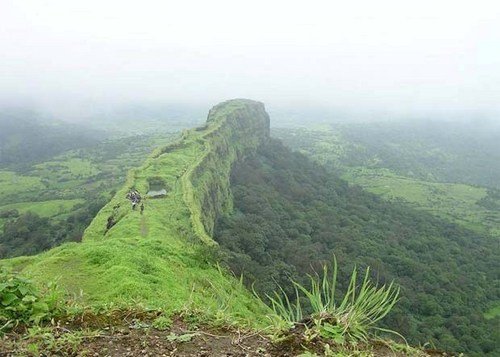
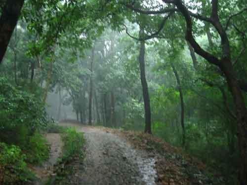
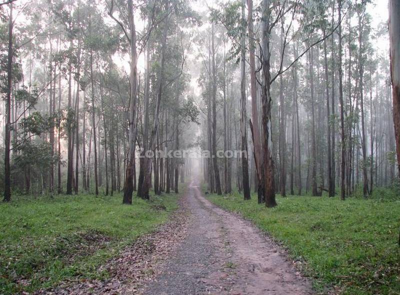
Valley areas of the park are in a Tropical and subtropical moist broadleaf forests Ecoregion. Hilly areas above 1,000 m are in a South Western Ghats montane rain forests region. Above 1,500 m, the evergreen forests begin to give way to stunted forests, called sholas, interspersed with open grassland. Both are very important to naturalists, biologists and other researchers because the rich biodiversity here has never been disturbed by human settlements. Several threatened species are endemic here. New plant and animal species are often discovered here.


How to Reach

BY RAIL: 

The nearest Railhead is Palakkad Junction (Olavacode) which is nearly 60 Kms away from the               base camp of the National Park, Mukkali .
Shornur junction , another  railhead is about 75 Km from the base camp of the National Park, Mukkali.
Coimbatore Junction in Tamil Nadu is also 45 km away from Mukkali, the base camp.

BY AIR:

Nearest Air Ports are Cochin (135KM), Coimbatore (55 KM) and Calicut (80KM).

BY ROAD:

From East: Palakkad (60 KM) and Coimbatore (45 KM)
From South : Thrissur (115KM) and Shornur (75 KM)
From North : Calicut (120KM)
The nearest town is Mannarkkad, which is 19 km from Mukkali.

GUIDES
Eco Development Committee members of Silent Valley National Park act as guides. The directions and advises of the guides shall be followed diligently while trekking inside the forests. Suggestions and complaints if any can be reported to the Office of the Asst.Wildlife Warden, Mukkali.

POINTS TO REMEMBER

  • Come with a mind to learn more about nature and enjoy the beauty and tranquillity of the place.
  • Remember that you are visiting a very precious Rain Forest area and approach it with respect.
  • Bring dull coloured cotton clothing, shoe,  camera, and other essential items.
  • Light warm clothes are preferred during winter season.
  • Liquor is strictly prohibited.
  • Plastic carry bags and Plastic bottles are not permitted inside the Park.
  • Carry your belongings in rucksacks or cotton bags
  • Listen to your guide. Never make noise inside forest areas, do not walk alone and be always with the group.
  • Littering of the forest area is a crime against nature.


ENTRANCE

Entrance fee                                       Bus Fare
                           Indian Nationals


Bonafide Students  25/ Head             175/ Head
Adults                    35/ Head             175/ Head
foreigners               220/ Head           175/ Head


Camera Charge

Video Camera  200/ Day 
Still Camera  25/ Day 


Jeeps

Mukkali Drivers’ EDC, Jeeps
(6 persons)  1000/trip (Excluding entrance fee)


From November to February is the best time to visit Silent Valley National Park

Gallery

Images of Solent Valley National Park


Thursday, 8 March 2012

Edakkal caves- The imprints of history

Edakkal Caves- Wayanad

Edakkal Caves are two natural caves located 1,200 metres above sea level on Ambukutty Mala 25 km from Kalpetta. The travel time to Edakkal Caves from Wayanad is 1 – 1 1/2 hours and it is a cave with carvings and paintings that touched stone age.
distant view of edakkal caves

Edakkal Caves are two natural caves at a remote location at Edakkal, 25 km from Kalpetta in the Wayanad district of Kerala in India's Western Ghats. They lie 1,200 metres above sea level on Ambukutty Mala, beside an ancient trade route connecting the high mountains of Mysore to the ports of the Malabar coast. Inside the caves are pictorial writings believed to date to at least 5000 BC, from the Neolithic man, indicating the presence of a prehistoric civilization or settlement in this region. The Stone Age carvings of Edakkal are rare and are the only known examples from south India


These are cleft or rift approximately 96 feet by 22 feet, a 30-foot-deep fissure caused by a piece of rock splitting away from the main body. On one side of the cleft is a rock weighing several tons that covers the cleft to form the 'roof' of the cave. The carvings are of human and animal figures, tools used by humans and of symbols yet to be deciphered, suggesting the presence of a prehistoric settlement.


These are cleft or rift approximately 96 feet by 22 feet, a 30-foot-deep fissure caused by a piece of rock splitting away from the main body. On one side of the cleft is a rock weighing several tons that covers the cleft to form the 'roof' of the cave. The carvings are of human and animal figures, tools used by humans and of symbols yet to be deciphered, suggesting the presence of a prehistoric settlement.


The petroglyphs inside the cave are of at least three types. The oldest may date back to over 8,000 years. Evidences suggest that the Edakkal caves were inhabited several times at different points in history.
The caves were discovered by Fred Fawcett, a police official of the erstwhile Malabar state in 1890 who immediately recognised their anthropological and historical importance. He wrote an article about them, attracting the attention of scholars.

The caves contain drawings that range over periods from as early as 5000 BC to 1000 BC. The youngest group of paintings have been in the news for a possible connection to the Indus Valley Civilization.


courtesy:wayanad.com

Wednesday, 7 March 2012

The Brihadeeswarar Temple - secrets behind the ancient indian architecture


Brihadeeswarar Temple

the brihadeeswarar temple


The Peruvudaiyar Koyil also known as Brihadeeswarar Temple,at Thanjavur in Tamil Nadu, is the world's first complete granite temple and a brilliant example of the major heights achieved by Cholas in Tamil architecture.. It remains India's largest temple and is one of the greatest glories of Indian architecture. The temple is part of the UNESCO World Heritage Site "Great Living Chola Temples".

Secrets of Brihadeeswarar Temple


 This temple is one of the world's most prized architectural sites. The temple stands amidst fortified walls that were probably added in the 16th century. The vimana or the temple tower is 216 ft (66 m) high and is among the tallest of its kind in the world. The Kumbam (or Kalash or Chikharam) (apex or the bulbous structure on the top) of the temple is not carved out of a single stone as widely believed. The shadow of the gopuram never falls on the ground. However, some scholars have dismissed this as a myth. it falls somewhere else. nobody have found the shadow till now. It shows the architectural excellence of india before 1000 years also. There is a big statue of Nandi (sacred bull), carved out of a single rock, at the entrance measuring about 16 feet long and 13 feet high.

the gopura of brihadeeswarar temole whoose shadow is belived to be not fallen on earth

There is a big statue of Nandi (sacred bull), carved out of a single rock, at the entrance measuring about 16 feet long and 13 feet high. 


the nandi at the entrance


The Temple


The main temple is in the center of the spacious quadrangle composed of a sanctuary, a Nandi, a pillared hall and mandapas, and many sub-shrines. The most important part of the temple is the inner mandapa which is surrounded by massive walls that are divided into levels by sharply cut sculptures and pilasters providing deep bays and recesses. The karuvarai, a Tamil word meaning the interior of the sanctum sanctorum, is the inner most sanctum and focus of the temple where an image of the primary deity, Shiva, resides. Inside is a huge stone linga. Only priests are allowed to enter this inner-most chamber.

the large nandi carved out from a single rock


Not only the temple and the "moolavar", (prime deity, Shiva) but all other deities (Koshta Moorthigal) like Dakshinamurthy, Suriyan (Sun), Chandran (Moon) are very huge sized. Especially, Brahadeeswar temple is one of the rare temples which has statues for "Ashta dik paalakas" (Lords of all Eight Directions) — Indra, Varuna, Agni, Eesana, Vayu, Niruthi, Yama, Kubera — each of which is a life-like statue

Transport details

Thanjavur can be reached easily by road, rail and air. Tamil Nadu state government runs frequent public buses from nearby Trichy, Chennai, Kumbakonam, Pudukkottai, Pattukkottai, Tirunelveli, Karur, Nagapattinam, Coimbatore and many other cities in the state. From the state capital Chennai, a National Highway (NH 45-A) linking Chennai with Chidambaram, Mayavaram, Kumbakonam, Thanjavur, and Nagappatinam provides convenient access to tourists who come to visit Thanjavur and the adjoining towns. There are also several buses operated by private bus operators.

Rail services are run by Indian Railways from many cities across India including Chennai, Trichy, Tirunelveli, Madurai and Nagore. The train station is Thanjavur Junction.

Tiruchirapalli Airport is the nearest airport, located 65 km away.


Images Of Brihadeeswara Temple


long view of the temple

Inscriptions about the workers who worked to build the temple


the sculptures for sale in tanjore and the entrance to the temple
sivalingams in temple


 courtesy: wikipedia.com, manukmsv.wordpress.com